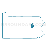
ORANGEVILLE Voting District, Columbia County, Pennsylvania
About
Outline

Summary
| Unique Area Identifier | 658702 |
| Name | ORANGEVILLE Voting District |
| County | Columbia County |
| State | Pennsylvania |
| Area (square miles) | 0.45 |
| Land Area (square miles) | 0.45 |
| Water Area (square miles) | 0.01 |
| % of Land Area | 98.16 |
| % of Water Area | 1.84 |
| Latitude of the Internal Point | 41.07695090 |
| Longtitude of the Internal Point | -76.41346370 |
Maps


Graphs
Select a template below for downloading or customizing gragh for ORANGEVILLE Voting District, Columbia County, Pennsylvania